

To plan your Boston sightseeing experience, use the map and attractions guide on this page to locate top attractions, tours, events, and places to go in Boston, and plan your vacation experience.
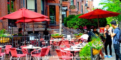
Boston is a city of gorgeous neighborhoods - Beacon Hill, Historic Downtown, Back Bay, the North End, the West End, Fenway, the Waterfront, Charlestown. Just across the Charles River is the city of Cambridge, home to Harvard University and MIT (Massachusetts Institute of Science).
Each Boston neighborhood has its own personality, attractions, mouth-watering restaurants, and fascinating places to visit and things to do.
Boston's compact size makes sightseeing easy because most of our top attractions cluster in just the few central neighborhoods shown on the map on this page. You can easily walk from one area to the next, so getting around is fast and convenient.
The best way to start planning your Boston travel itinerary, especially if you'll be here just for a short time, is to focus on the top attractions in your "must see" list, and then find other interesting places to visit located nearby.
Use our Boston sightseeing map and attraction locations to get started.
More about Boston neighborhoods
Top photo: View of Back Bay and Prudential Tower
Boston Discovery Guide is a reader-supported publication. When you buy through our links, we may earn a commission at no additional cost for you. Learn more
Boston Sightseeing Attractions Map

Most of Boston's top attractions, events, and historic sites are located in the city's central neighborhoods shown on this map
Want to know which sightseeing attractions are in a specific neighborhood? Click on it in the map, or scroll down to the neighborhood overview below.
Want to find out about the best hotels in each neighborhood? Check our Boston Hotel Guide.
Fun Boston Tours
To get an in-depth view of a particular area or an experience tailored to your special interests, consider these tours led by professional guides:
Another good way to get to know Boston is to simply wander around and explore - easy to do because of the city's compact size.
Guide to Sightseeing Attractions in Each Boston Neighborhood


- Faneuil Hall Marketplace / Quincy Hall
- Haymarket - Boston's Oldest Outdoor Market
- Boston Holocaust Memorial
- Irish Pubs and Historic Taverns

- Charles Street Antique Shops
- Black Heritage Trail
- Vilna Shul
- The nearby Boston Esplanade


Downtown Waterfront


- Leader Bank Pavilion
- CruisePort - Boston's Cruise Ship Pier
- Boston ICA (Institute of Contemporary Art)

- Boston Children's Museum
- Boston Tea Party Museum
- Fort Point Open Studios in May and in October.


West End / Government Center

No major attractions in tiny Bay Village but the Federal and Art Deco buildings lining the narrow streets of this tranquil, little-known neighborhood - one of Boston's "hidden secrets" - are worth seeing.

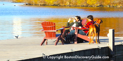
Charles River & Boston Harbor

Cambridge
- Harvard University and MIT
- Harvard Museum of Natural History
- HONK! Street Music Festival in October
- Charles River Festival in June
Want more information about Boston neighborhoods, including where to eat, stay, and shop? Check out our Boston Neighborhood Guide.
Key Attractions and Events in Other Boston Neighborhoods
Although most tourist attractions cluster in Boston's central neighborhoods, a few are located in surrounding mostly-residential areas.
Here are the neighborhoods and areas where you'll find other key Boston sightseeing attractions, historic sites, cultural venues, entertainment, and tourism-related attractions and events.
Although not all are near a T station, shared ride services such as Uber and Lyft make them easy to get to.
East Boston
- Boston Logan Airport
- Constitution Beach
- Piers Park and Piers Park Sailing Center
- Belle Isle Marsh Reservation
- The Watershed (ICA seasonal exhibition space)
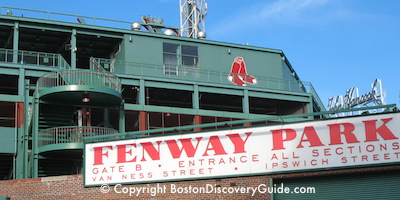
South Boston
- St Patrick's Day Parade
- Castle Island
- Samuel Adams Brewery
- Carson Beach, M Street Beach
Dorchester
- John F Kennedy Library and Museum
- Franklin Park Zoo
- Strand Theatre
- University of Massachusetts, Boston
- Edward M. Kennedy Institute
Jamaica Plain
- Lilac Sunday at Arnold Arboretum
- Latin Quarter
- Riot Theatre
- Forest Hill Cemetery (also an arboretum and sculpture garden)
Chestnut Hill (Newton)
- Chestnut Hill Mmall
- Boston Collete
Allston / Brighton
- Paradise Rock Club
- Boston Landing Sports Complex
Roslindale
- Roslindale Village Main Street Farmers Market
- Franklin Park (shared with Dorchester)
Roxbury
- National Center of Afro-American Artists
- Roxbury International Film Festival
- Diablo Glass School
More Fun Ways to See Boston
Need a Boston Hotel or Apartment?
Use this handy map from Booking.com to find the perfect place to stay. Just enter your dates to find what's available, see the best rates, and make your reservations.


